
Hurricane victims’ claims to be sped up with 360-degree imagery
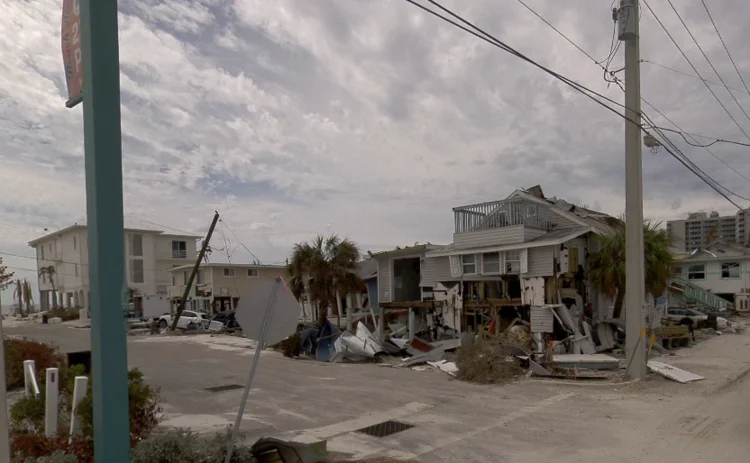

McKenzie Intelligence Services has piloted CAT360 to boost insurers’ responses to US hurricane losses and speed up claims by providing ground-level imagery.
MIS is a provider of geospatial intelligence that aims to empower insurers to respond to catastrophes, whether natural or man-made, and already provides satellite and aerial imagery to help carriers
Only users who have a paid subscription or are part of a corporate subscription are able to print or copy content.
To access these options, along with all other subscription benefits, please contact info@postonline.co.uk or view our subscription options here: http://subscriptions.postonline.co.uk/subscribe
You are currently unable to print this content. Please contact info@postonline.co.uk to find out more.
You are currently unable to copy this content. Please contact info@postonline.co.uk to find out more.
Copyright Infopro Digital Limited. All rights reserved.
You may share this content using our article tools. Printing this content is for the sole use of the Authorised User (named subscriber), as outlined in our terms and conditions - https://www.infopro-insight.com/terms-conditions/insight-subscriptions/
If you would like to purchase additional rights please email info@postonline.co.uk
Copyright Infopro Digital Limited. All rights reserved.
You may share this content using our article tools. Copying this content is for the sole use of the Authorised User (named subscriber), as outlined in our terms and conditions - https://www.infopro-insight.com/terms-conditions/insight-subscriptions/
If you would like to purchase additional rights please email info@postonline.co.uk
More on News

Ageas’ sustainability workshop; Addept acquires Policywise; Co-op’s renters insurance
Friday Round-Up: Insurance Post wraps up the major insurance deals, launches, investments and strategic moves of the week.

MOJ asked for clarity on insurers saying ‘sorry’
Insurers and legal experts have welcomed a Ministry of Justice consultation on amending the law of apologies, but have called for more reassurance that saying sorry to policyholders won't be deemed an admission of liability.

Gain urges neurodiversity inclusion in FCA D&I plan
The Group for Autism, Insurance and NeurodIversity has called on the Financial Conduct Authority to include neurodiversity as a category in its diversity and inclusion proposal.

Repair costs continue to push up home insurance premiums
According to the Association of British Insurers’ premium tracker, home insurance premiums increased 3% in the first quarter of 2024, following a severe winter for weather damage.
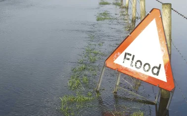
Flood Re makes changes to ‘address evolving landscape’
Flood Re has today announced changes to key scheme parameters, with the aim of ensuring the continued availability and affordability of flood insurance.

Toilet fraudster’s claim hits the fan
A claimant, who attempted to claim for £200,000 after slipping in a restaurant toilet, is now facing the prospect of having to repay at least £40,000 in legal fees after being found to be fundamentally dishonest.

Cytora to streamline ‘time-consuming’ data gathering within large fleets
Cytora has partnered with risk management platform SambaSafety in a bid to streamline workflows and improve risk selection of motor insurance for large fleets.

Flock teases more deals as it expands into taxi fleets
Commercial fleet insurtech Flock has entered a capacity partnership with The Acorn Group, targeting black taxi as well as Uber fleets.